The Legendary Ho Chi Minh Trail
The Trường Sơn Strategic Supply Route, also known as the Ho Chi Minh Trail, is a monumental military project. It is the crystallization of the extraordinary will, determination, courage, and creativity of the Vietnamese people during the prolonged struggle against the United States to save the nation.
The Trường Sơn “line of fire” was created in a special historical context. In July 1954, the Geneva Accords were signed to end the war and restore peace in the three Indochinese countries. Vietnam was temporarily divided into two regions along the 17th parallel. The participants of the conference emphasized that “under no circumstances can this be considered as a political or territorial boundary.” This division was only temporary. The two regions were to be unified before July 1956 through “free and democratic” general elections. The French army had to withdraw from the North, and the Viet Minh had to withdraw from the South within 300 days; people had the right to choose to live in the North or the South, and during that time, they were free to travel. Foreign military intervention in Vietnam was strictly prohibited. However, the U.S. government representatives did not sign the final declaration of the Accords. They used this to blatantly refuse to accept the terms of the Accords and carried out plans to invade the South and permanently divide Vietnam.
By 1959, the terror policies of the Ngô Đình Diệm regime in South Vietnam forced the revolutionary forces in the South and the government in the North to face a harsh choice: either endure these persecutions, remain loyal to the Geneva Accords, and wait for the general elections, or resist. At the beginning of May 1959, the 15th Central Committee Conference was held and decided that the path of revolution in the South must combine political struggle with armed struggle, emphasizing that significant support from the North was the most crucial factor for the prolonged resistance.
During this period, communication between the revolutionary forces in the two regions was extremely difficult. The only communication line was through western Quảng Trị, managed by the Interzone 5 Committee. However, this route could not meet the growing demands for substantial support in manpower and materials for the southern battlefield as the resistance continued to develop. Therefore, the Politburo assigned the Central Military Commission to research and organize a special military transport group to establish a transportation route to deliver personnel, weapons, medical supplies, food, and other essential goods to the South. This task was identified as “a significant, strategic task directly related to the liberation of the South and the unification of the country.”
On May 19, 1959, Unit 559, led by Comrade Võ Bẩm, was established and designated as the “special military task force” to carry out this mission. Khe Hó, located in a valley in the southwest of Vĩnh Linh District (Quảng Trị), was chosen as the starting point to open the route “heading to the South.” In the early stages, there was no path at all. The guiding principle for opening the route was “cut through the mountains, follow the mountain peaks, and avoid all old paths.” The soldiers and officers, with the slogan “Find the way to go, pave the way to reach, fight the enemy to advance” and the discipline “Go without leaving traces, cook without smoke, talk without sound,” successfully overcame Trường Sơn range with its deep rivers, dangerous streams, high passes, and the enemy’s tight system of posts and stations. They delivered the first batch of supplies by carrying and hauling them to the people and soldiers of Interzone V on August 13, 1959.
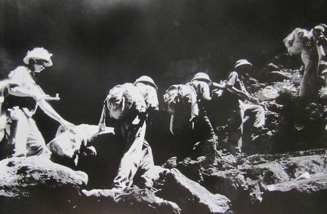
Officers and soldiers crossing mountains and forests in Trường Sơn range to advance to the South. (Source: Ho Chi Minh Trail Museum)
In 1960, the American imperialists implemented the “Special War” strategy. The transportation route on the eastern side of Trường Sơn (Vietnam) faced severe enemy attacks. From 1961, Unit 559 shifted to opening a transportation route on the western side of Trường Sơn (Laos), thereby breaking the single-route dependency. Transporting goods also transitioned from manual carrying to opening routes for rudimentary vehicles, and initially, for mechanized transport.
In 1962, Unit 559 delivered 961 tons of weapons, 7,800 tons of rice, and facilitated the movement of nearly 10,000 personnel to and from the battlefields via these transport routes. From that year onwards, most of the severely wounded soldiers were transported from the southern battlefields to the North for treatment via this route. By the end of 1964, the Ho Chi Minh Trail had been extended to include 781 kilometers of motor roads, more than 600 kilometers of communication and manual transportation paths. A network of transportation from East to West Trường Sơn was established, with three parallel systems: communication routes, manual transport routes, and mechanized transport routes.
From 1968, the Trường Sơn soldiers began constructing a fuel pipeline from Nam Đàn (Nghệ An). By 1973, the fuel flow had reached Bù Gia Mập (Bình Phước). By 1975, after seven years of construction and development, the pipeline system had a total length of over 5,000 km, starting from the Vietnam-China border and the northern ports to the Southern region. Along the Trường Sơn route, there were 114 pumping stations with a capacity of 600-800 cubic meters per day and over 100 fuel depots with a total capacity of more than 300,000 cubic meters. The Americans had to acknowledge this as a “formidable project” in preparing the infrastructure for the Vietnamese combat efforts.
Throughout the war, the Ho Chi Minh Trail was a primary target for fierce attacks by the enemy using the most modern and advanced weapons. The US and South Vietnamese forces launched many major campaigns to sever the Ho Chi Minh Trail and cut off the supply line from the North to the South and to the neighboring countries of Laos and Cambodia.
In the ten years from 1961 to 1971, 80 million liters of chemical agents, including 61% of Agent Orange containing 366 kg of dioxin, were sprayed during the Vietnam War. Nearly 4 million tons of bombs and mines were dropped on Trường Sơn to destroy the routes, annihilate convoys, and obliterate all life, reducing the forest to bare leaves and turning rocky mountains into mud. However, the U.S.’s war efforts using the most advanced electronic weapons failed against the determined and innovative resistance of the Trường Sơn soldiers.
As reported in the French newspaper Le Figaro by scholar Jacques Rema on December 31, 1971: “The troubling thing is that the Ho Chi Minh Trail cannot be destroyed… The United States has spent billions of dollars trying to strangle the Ho Chi Minh Trail. It still exists. It is like a hydra with a hundred heads that always regrows. It’s not the heads but the arms of this snake that keep regrowing because they cannot be severed all at once.” U.S. Secretary of Defense McNamara bitterly admitted, “People still see a large flow of men and materials from the North to the South, yet there is no way to stop it.”
From 1959 to 1975, on the legendary Ho Chi Minh Trail, the units transported and facilitated the movement of over 2 million soldiers and officials, and more than 1 million tons of goods to the southern battlefields. The support in manpower and resources from the northern rear through the Trường Sơn supply line helped our troops “eat well, fight well,” achieving resounding victories on the battlefields, making our way to the day of total victory and unification.
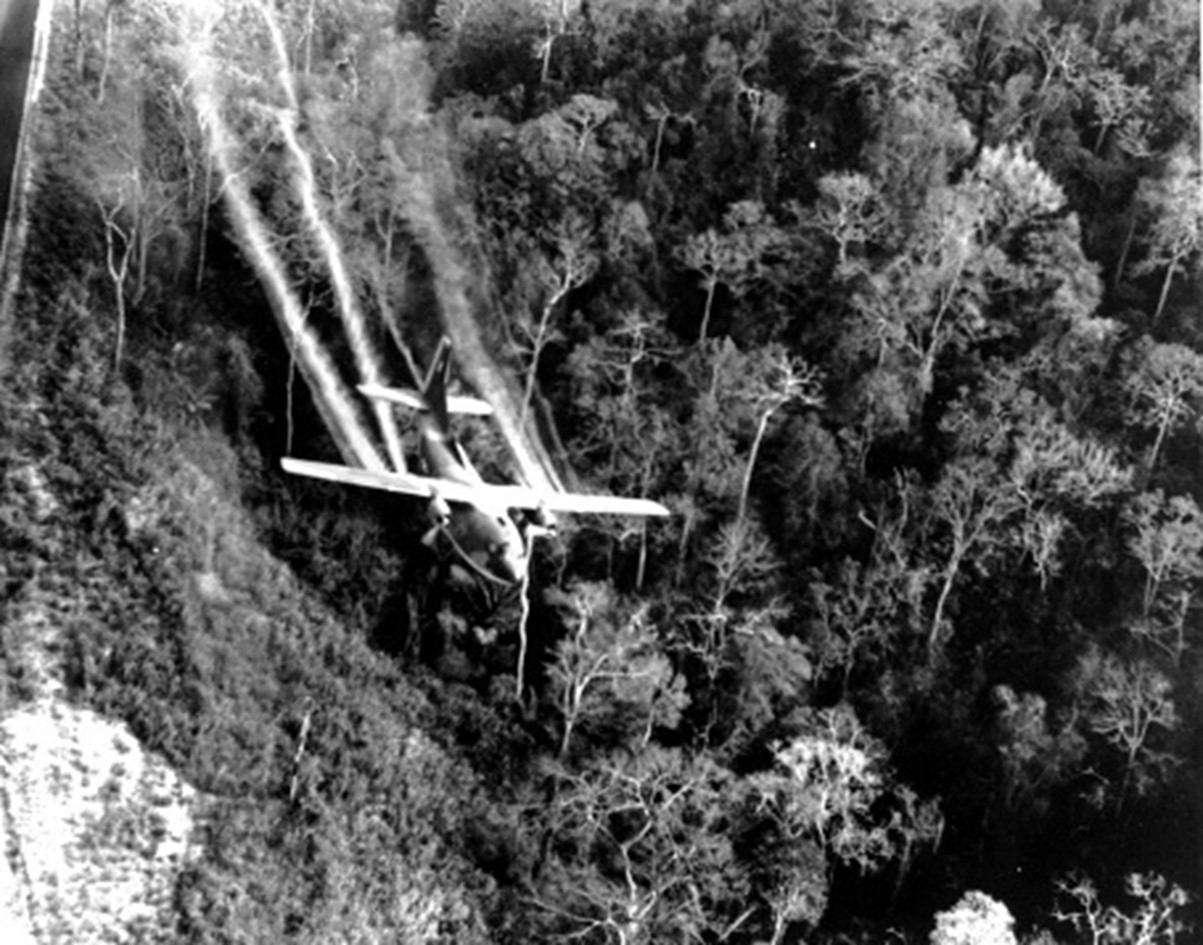
The U.S. Air Force spraying chemicals to destroy the forests of Trường Sơn mountain range to hinder the advance of the soldiers (Source: Vietnam Military History Museum)
Over 16 years (1959 – 1975), from the trails along the majestic Trường Sơn range, the route was continuously expanded and extended like a “labyrinth,” covering the entire Trường Sơn range. With a total length of up to 20,000 km, it spanned North to South and the three Indochinese countries, reaching all battlefields. It became a crucial artery, supplying manpower, food, and weapons from the major northern rear to the major southern frontline, playing a particularly important role in the victory of the resistance against the US to save the nation.
After the day of unification, the legendary Ho Chi Minh Trail in the resistance against the US, assumed a new historical mission in serving the country’s integration and development period. In 1997, the Party and Government assigned the Ministry of Transport to study and plan to establish the second north-south road axis (after National Highway 1A) in the western part of the country, initially named the “North-South Highway.” In August 1998, the Politburo officially renamed it the Ho Chi Minh Trail, with a total length of over 3,000 km passing through 30 provinces and cities, starting from Cao Bằng, through the central provinces, Central Highlands, Southeast region, and ending in Cà Mau.
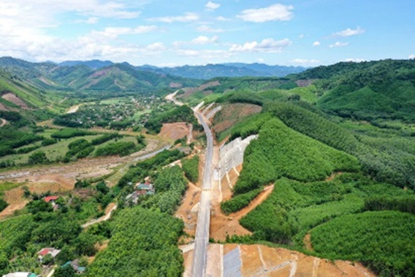
The modern Ho Chi Minh Trail with the lush green color of forest leaves
(Source: Vietnam Military History Museum)
Currently, the Ho Chi Minh Trail is a strategically important project, creating connectivity and gradually completing the seamless transportation network from North to Central to South. It drives economic and social development and contributes to ensuring border defense, political stability, and national security and defense.
Editorial Team from the Conservation and Exhibition Department

